£2,395.00 + V.A.T. per licence
Ready to takeoff?

Guaranteed takeoff accuracy that increases productivity.
Choose the best earthworks estimating software.

Takeoffs simplified

SiteWorx O/S earthworks estimating software operates seamlessly with PDF, vector PDF, DWG, DXF and other raster and vector file formats. The many more benefits of SiteWorx O/S earthwork takeoff and excavation bidding software include –

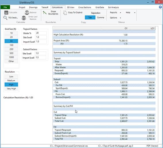
  • Cut and fill takeoff software that delivers accurate and rapid calculation of cut, fill and sub-grade material volume, making paper plans redundant
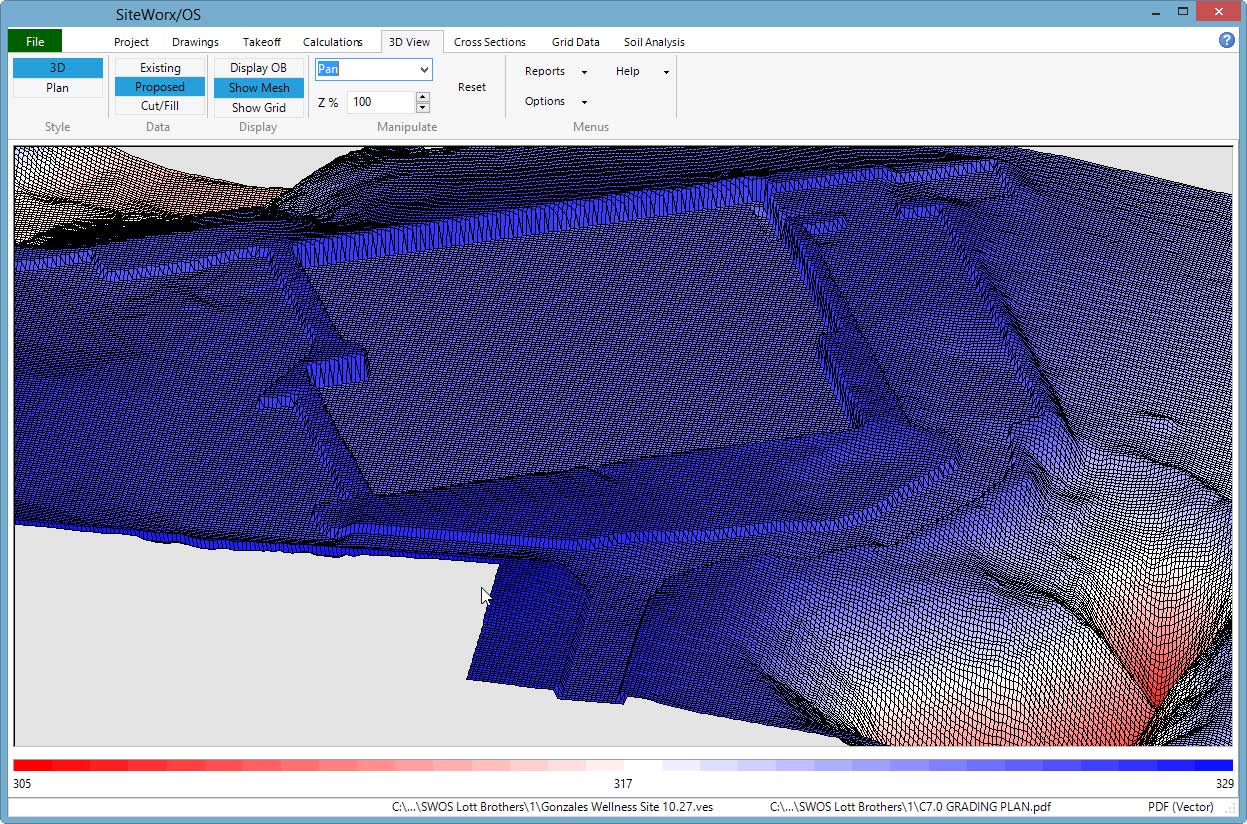
  • Well-defined audit trail with 3D models of existing and proposed sites along with the location of cuts and fills
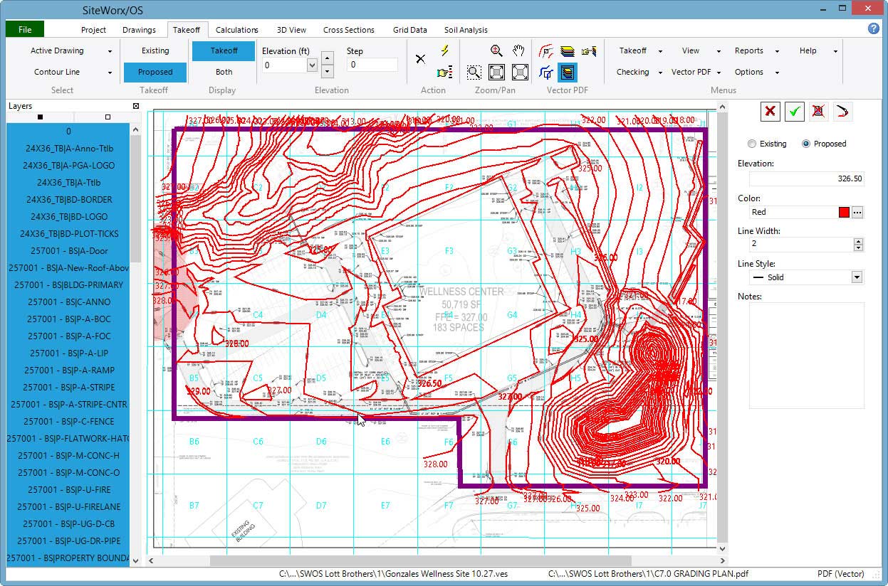
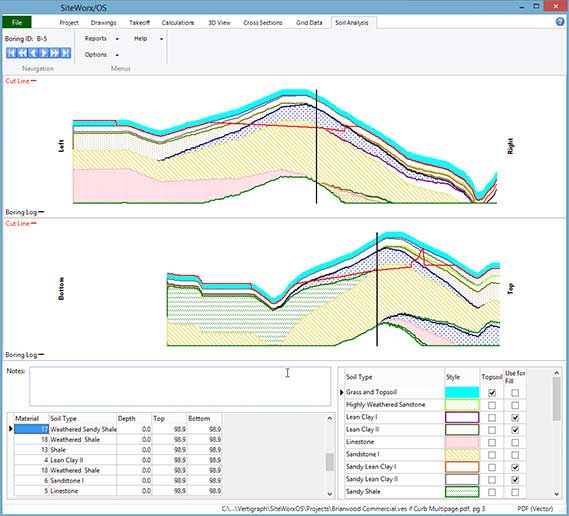
  • Easy recording of project boundaries, topsoil strip and re-spread areas, contour lines, sloping design lines, spot elevations, borings, trench details and areas with subgrade materials
3D estimating model

SiteWorx O/S Video

Training videos available...

SiteWorx O/S benefits

Simply import contour lines, points and elevations in seconds from DWG files. With earthwork takeoff software you can also –

  • Takeoff contour lines with a single click of a mouse from vector files
  • Select and isolate design layers from vector files
  • Snap to the object to obtain unrivaled accuracy from vector files
  • SiteWorx O/S project files can contain a range of file types
  • Easily trace contour lines from raster files
  • Keyboard shortcut keys activate arc and other commands
  • Copy areas and exclude them from topsoil re-spread regions
Grading plan made with SiteWorx O/S

Easily compute over-excavate and backfill volumes with SiteWorx O/S. Further features include –

  • Trench materials and volumes are separately disclosed
  • Broad, informative reporting with 3D graphics and clear, concise reporting of volumes
  • How to calculate cut and fill. Existing and proposed elevations with the cut/fill depths are displayed at any point on the 3D surface model
  • Site balancing adjustment is provided
  • Boring log input delivers cut volumes by soil type
  • Errors are reduced thanks to automatic checking
  • Incorrect elevations are easy to find and edit

Easily export results to Microsoft Excel, Word, PDF and other file formats. Also –

  • Copy results and paste into Excel and other applications with ease
  • Export GPS surface model points as a CSV or DWG file

You’ll find that SiteWorx O/S is reassuringly cloud storage-capable by backing-up the project and grading files to any cloud storage drive you choose. It’s also simple to export the takeoff as a DWG file.

And with SiteWorx O/S Version 10 now available, you can find the solution that works best for you.

Contact us today to see how SiteWorx O/S will make life a little easier by
speeding up the time-consuming takeoff process.

Contact Us